South Dakota Statewide Rural Wildlife Crossings Study
Study Overview
The South Dakota Statewide Rural Wildlife Crossing Study was initiated by South Dakota Department of Transportation (SDDOT) in conjunction with South Dakota Department of Game, Fish, and Parks (SDGFP), South Dakota Department of Public Safety (SDDPS), and the Federal Highway Administration (FHWA). The study will examine transportation-related data plus wildlife data to identify the locations of areas with the most Wildlife-Vehicle Collisions (WVCs) on all South Dakota highways, and then develop recommendations for the appropriate wildlife mitigation at those locations across the state. The final products will guide SDDOT in the implementation of the recommended mitigation strategies.
Need for the Study
Wildlife-vehicle collisions are a major challenge for South Dakota. The crash type with the greatest numbers in South Dakota are wildlife-vehicle crashes. While the national average for crashes that involve wildlife is five percent, South Dakota wildlife-related crashes average 25 percent of all reported crashes, the highest percent of all U.S. states (Cramer et al. 2022). This study will help South Dakota identify the top wildlife-crash locations with a hot spot analysis that ranks the areas based on crashes rates. Additional data on the locations of large wild animal populations can help predict where wildlife need to cross roads, regardless of reported crashes. With the results of this study, SDDOT will be positioned to proactively plan for placing wildlife mitigation in the areas where motorists are at greatest risk.
About the Study
The study will be conducted by The Wildlife Connectivity Institute (WCI) and be comprised of two main phases that will be completed by the end of December 2026.
The first phase will seek to establish existing conditions and identify significant wildlife-vehicle collision (WVC) locations. The second phase will evaluate and identify locations that are the best candidates for WVC solutions.
Schedule
Tasks |
Timeline |
| Phase One: Establish Existing Conditions and ID Significant WVC Locations | |
| Obtain data and baseline conditions Gather GIS data, studies, meet with agency personnel for learning of data and data availability. | Summer – Fall 2025 |
| Map Roads and Crash Data, begin Optimized Hot Spot Analysis | Fall 2025 |
| Add additional information to the crash hot spots to model multiple factors and apply a second Optimized Hot Spot Analysis to generate Wildlife-Vehicle Conflict Locations. | Fall 2025, Early winter 2025-2026 |
| Draft Phase One Report | Winter 2026 |
| Public Meeting One | Late Winter 2026 |
| Final Phase One Report | Late Winter 2026 |
| Phase Two: Evaluate and ID Locations for WVC Solutions | |
| Develop WVC Mitigation Strategies for Study Locations | Spring 2026 |
| Cost Estimates of recommended mitigation measures | Spring 2026 |
| Prioritize Projects | Late Spring 2026 - Early Summer 2026 |
| Draft Phase Two Report | Fall 2026 |
| Public Meeting Two | Fall 2026 |
| Final Phase Two Report and Final Report | Early December 2026 |
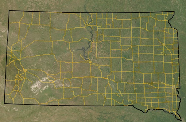
Study Area
This study is conducted across all of South Dakota on SDDOT administered roads.
Public Involvement
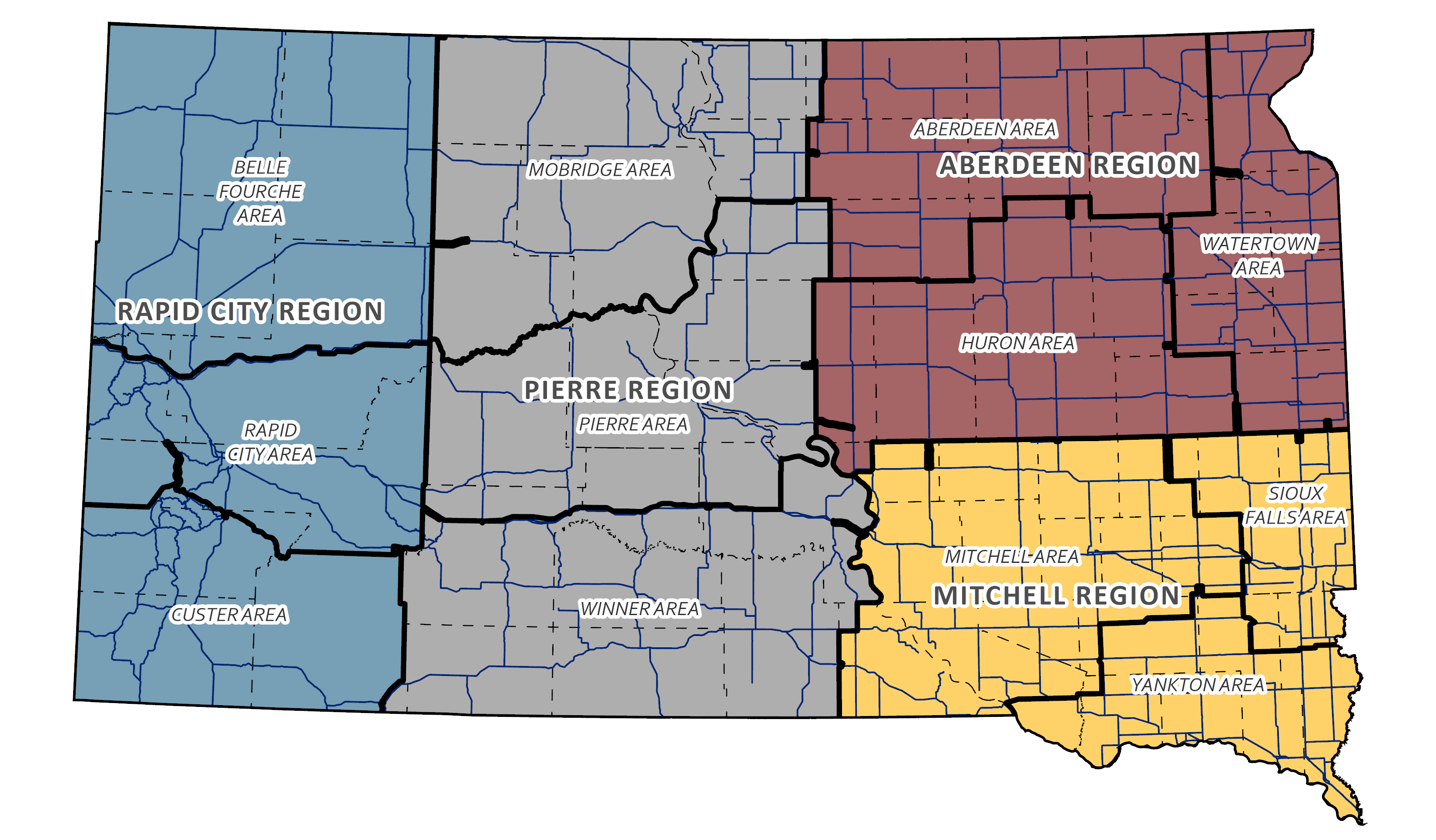
Public involvement is an integral component of the South Dakota Statewide Rural Wildlife Crossings Study. The WCI research team in conjunction with SDDOT will implement comprehensive public engagement strategies throughout the entirety of the study to ensure stakeholders are informed of the project’s objectives, progress, and outcomes, and that the public and stakeholders have meaningful opportunities to contribute to the process. A key part of the study’s public outreach will involve working with federally recognized Tribal nations within South Dakota to learn how and where WVCs impact these communities. In addition to two online virtual public meetings, four virtual Stakeholder meetings will be held. These meetings will be based on the four SDDOT Regions: Rapid City, Pierre, Aberdeen, and Mitchell. Please see the dates for the public meetings below. An interactive map will be available on this website where the public, stakeholders, and Tribal personnel can indicate problem areas for wildlife collisions, where wildlife is known to be in and along roads, and the potential solutions the users would like to see.
Public Meetings
During these meetings, community members will be invited to review, discuss, and provide feedback on the proposed study approaches.
- The first public meeting will be held in Late Winter of 2026.
- The second public meeting will be held In the fall of 2026.
- Stakeholder Meeting information coming soon.
Request for Landowner Comment
Survey Coming Soon.
Interactive Map
Interactive Map Coming Soon.
Study Documents
Past Study Reports
Guidelines for Wildlife Vehicle Collision Mitigation, Study SD2019-02
Reducing WVC in South Dakota 2016 Cramer et al.