South DakotaDepartment of Transportation
Transportation
Aviation
About Office of Aeronautics Services
Office of Aeronautics Services
Airports Conference
Aerospace Education
Airport Information
Links
Aviation Systems Plan
Bridges
Office of Bridge Design
Design & Plans
Historical Bridges
Inventory & Inspection
Posted Structures
Reference Information
SD Bridge Photos
Doing Business
Certification & Accreditation
About Certification & Accreditation
SDDOT Accreditation Certification List
Approved Products
Manuals & Documents
Welding Certifications
Training
Contractors
Bid Letting Information
Concrete Pipe Release
Contractors/Suppliers
Prequalified Contractors
CMS Web Reports
Disadvantaged Business Enterprise (DBE)
Fuel Price Index
Labor Compliance
Materials
Preconstruction Meetings
Price Adjustment Guidelines
Standard Specifications
Subcontract Requirements
Forms & Documents
Webinars
Alternative Contracting
Engineering/Design Services
Consultant Services
Downloadable Files
Manuals
News & Updates
Right of Way / Relocation Assistance
Standard Bid Items
Standard Plates
Surveyors
Utility Coordination
Environmental
About Environmental
Agreements
Endangered Species
Environmental Assessments
Forms
Public Involvement
Stormwater
Wetland Mitigation
Local Governments
About Local Governments
Bridge Improvement Grants
City/County Fund Balances
Emergency Relief (ER)
Federal Bridge Program
Forms & Documents
Secure Accounts Billing
Transportation Economic Development Grants
Urban Systems
Rural Access Infrastructure Fund Program
Traffic Incident Management
Training
Projects & Studies
Planning
Carbon Reduction Strategy
Freight Plan
Long Range Plan
Metropolitan Planning Organization
Non-state Public Road Inventory
Pavement Condition Monitoring
Pavement Management
South Dakota EV Fast Charging Plan
Statewide Transportation Improvement Program – STIP
Transportation Asset Management Plan (TAMP)
Inside SDDOT
Forms & Publications
Brochures
Forms
Manuals
Maps
Newsletters
Reports
SDDOT Engagement Opportunities
Join One of Our Contact Lists
Press Releases
Media Kits
News Stories
Branding and Identity Guidelines
Learn More about the SDDOT Logo
SDDOT Blog
Pavement Condition Monitoring
Pavement Condition Monitoring
Pavement Condition Monitoring uses sophisticated equipment to collect digital data about road surface profile, rut depth, slab faulting, pavement strength, and videologging. These data are utilized in pavement design and management, structural adequacy for load limit posting, and planning for the annual highway needs analysis/construction program. This activity is also responsible for updating the Roadway Information System (RIS) resulting from physical changes to the state highway system from annual highway construction and maintenance projects. Key components to the RIS database are Mileage Reference Markers, Roadway Features, Intersection, and Pavement Condition Measurement.
Surfacing Log
The Surfacing Log is a detailed report about the pavement surface of each section of State owned highway and includes the following information; surface width, type of material used to construct each layer of pavement, year each layer of pavement was constructed, thickness of the each layer of pavement, type of material use for the base course, thickness of the base course, and years that surface treatments were completed for each section of State owned highway.
Cover Page
Definitions
Cover Page
Definitions
Choose a County:
Highway Log
The Highway Log is a listing of classification codes used to categorize each section of State owned highway and consist of the Project Numbers, County, Federal Funding, State Administrative, Special Systems, Functional Classification, Surface Type, Shoulder Type, and the Curb and Gutter.
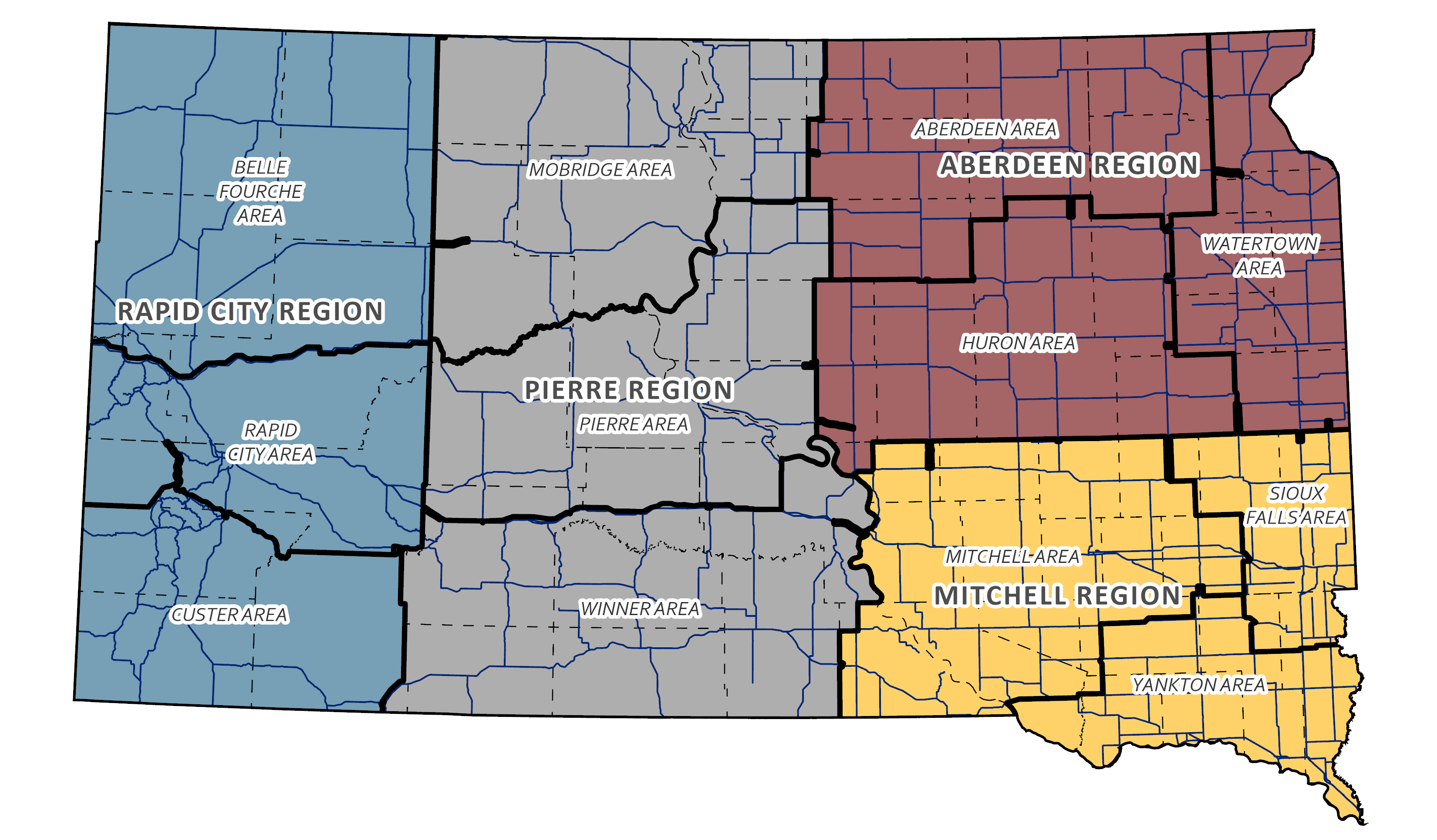
Aberdeen Region Highway Log
Mitchell Region Highway Log
Pierre Region Highway Log
Rapid City Region Highway Log
Aberdeen Region Highway Log
Mitchell Region Highway Log
Pierre Region Highway Log
Rapid City Region Highway Log
Test Equipment
Falling Weight Deflectometer
A FWD is designed to determine the strength of the pavement structure. The test vehicle drops a load of 9,000 lbs. on the pavement to simulate one wheel of a legally loaded semi-truck axle. The movement (deflection) caused by the load is recorded by seven deflection sensors located on the test vehicle. The deflection is used to determine the present condition of all layers of the pavement. This information is used to evaluate the types and timing of rehabilitation that may be applied to a pavement to extend its service life. FWD data is currently collected on Portland Cement Concrete (PCC) Restoration Projects, Asphalt Concrete projects programmed for reconstruction or resurfacing in the next 3 years, thin asphalt highways that may require load limits restrictions in the spring and fall, airport projects, and network level testing.

Pavement Profiler & Videolog
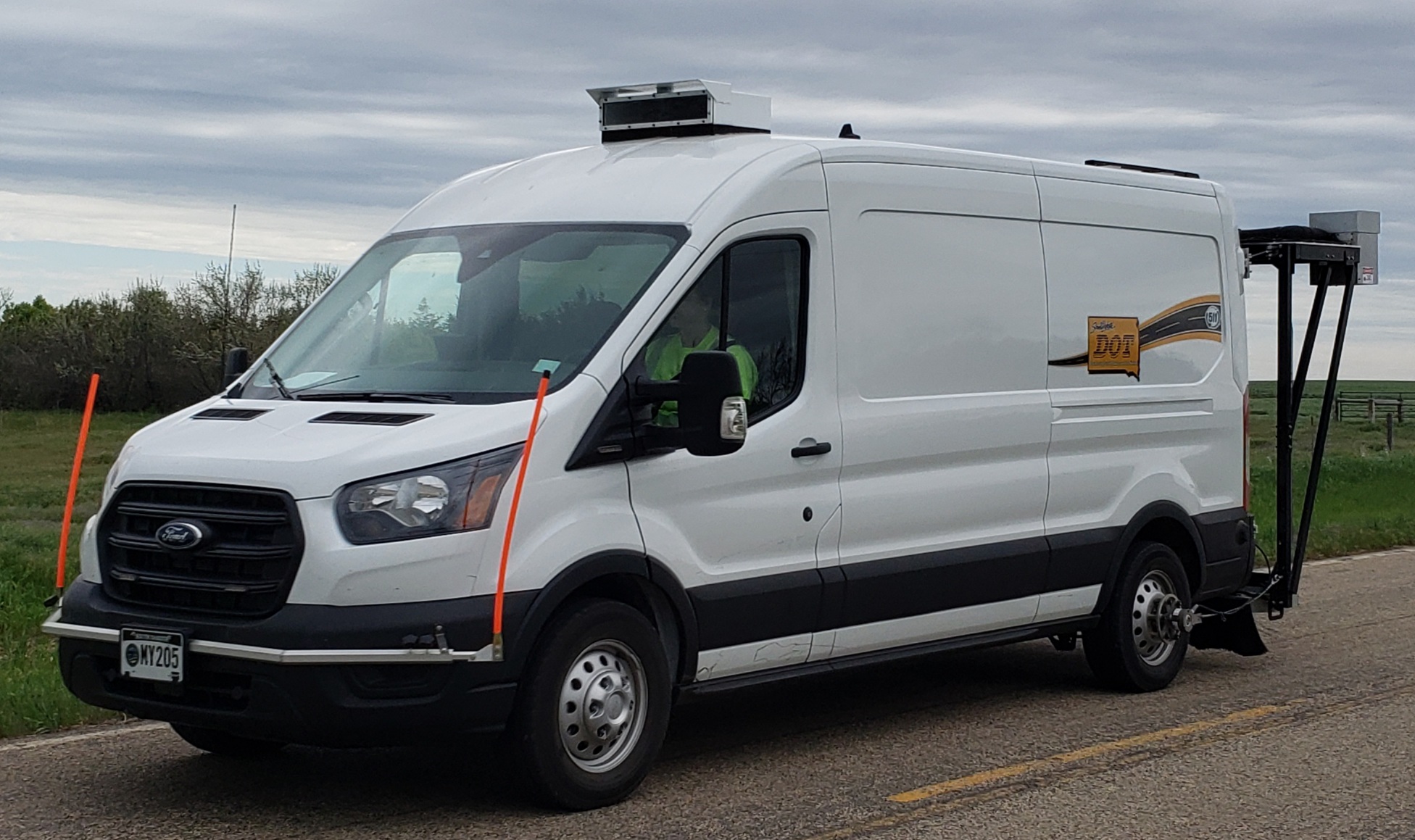
The SDDOT operates a multifunctional integrated road and pavement data collection vehicle. This system integrated several areas of pavement management data collection into one data collection system vehicle. These areas include: Roadway/Right-of-way Videologging, Pavement Distress Video Surveys, Road Profile Data Collection (Profile, Roughness, Faulting). The roadway and right-of-way videologging system consists of digital images collected, compressed and stored in the computer disk in real time. The images include a 120 degree composite view of the roadway and right-of-way of the road. The images can be collected and stored at operator selected intervals and synchronized with the distress and sensor data. The digital image files and pavement condition data can be uploaded to a network server hard disk and simultaneously accessed by users on the state network right at their desktop PC.

Falling Weight Deflectometer
A FWD is designed to determine the strength of the pavement structure. The test vehicle drops a load of 9,000 lbs. on the pavement to simulate one wheel of a legally loaded semi-truck axle. The movement (deflection) caused by the load is recorded by seven deflection sensors located on the test vehicle. The deflection is used to determine the present condition of all layers of the pavement. This information is used to evaluate the types and timing of rehabilitation that may be applied to a pavement to extend its service life. FWD data is currently collected on Portland Cement Concrete (PCC) Restoration Projects, Asphalt Concrete projects programmed for reconstruction or resurfacing in the next 3 years, thin asphalt highways that may require load limits restrictions in the spring and fall, airport projects, and network level testing.
Pavement Profiler & Videolog
The SDDOT operates a multifunctional integrated road and pavement data collection vehicle. This system integrated several areas of pavement management data collection into one data collection system vehicle. These areas include: Roadway/Right-of-way Videologging, Pavement Distress Video Surveys, Road Profile Data Collection (Profile, Roughness, Faulting). The roadway and right-of-way videologging system consists of digital images collected, compressed and stored in the computer disk in real time. The images include a 120 degree composite view of the roadway and right-of-way of the road. The images can be collected and stored at operator selected intervals and synchronized with the distress and sensor data. The digital image files and pavement condition data can be uploaded to a network server hard disk and simultaneously accessed by users on the state network right at their desktop PC.
Contact
Surfacing Log
Surfacing Log
The Surfacing Log is a detailed report about the pavement surface of each section of State owned highway and includes the following information; surface width, type of material used to construct each layer of pavement, year each layer of pavement was constructed, thickness of the each layer of pavement, type of material use for the base course, thickness of the base course, and years that surface treatments were completed for each section of State owned highway.
Cover Page
Definitions
Cover Page
Definitions
Construction Projects
Planning
Carbon Reduction Strategy
Freight Plan
Long Range Plan
Metropolitan Planning Organization
Non-state Public Road Inventory
Pavement Condition Monitoring
Pavement Management
South Dakota EV Fast Charging Plan
Statewide Transportation Improvement Program – STIP
Transportation Asset Management Plan (TAMP)
Studies
Special Studies
Public Meetings
SPR
US Highway 16 Corridor Study
I-229 Exit 3 (Minnesota Avenue) and Exit 4 (Cliff Avenue) Interchange & Environmental Study
I-229 Exit 6 (10th Street) Interchange Study
SD44 - Platte/Winner Bridge Corridor Study
I-90 Exit 46 (Elk Creek Road) Interchange Modification Study
I-90 Exit 63 (Box Elder/Ellsworth AFB Commercial Gate) Interchange Study
U.S. 385 Roadway Improvement Study
SD 100 Corridor Preservation Project
US14A/US85/Deadwood Box Corridor Study
South Veterans Parkway (Highway 100)
US Highway 212/Forest City Bridge Corridor Study
Union County Master Transportation Plan Study
Tabor to Platte Rail to Trail Feasibility Study
Bryant Master Transportation Plan Study
© 2026 State of South Dakota. All Rights Reserved.
South Dakota Department of Transportation
Becker-Hansen Building
700 E. Broadway Ave.
Pierre, SD 57501
Becker-Hansen Building
700 E. Broadway Ave.
Pierre, SD 57501
Powered by:
Modern Logic
Modern Logic
Region & Area Offices
Travelers
© 2026 State of South Dakota. All Rights Reserved.
South Dakota Department of Transportation
Becker-Hansen Building
700 E. Broadway Ave.
Pierre, SD 57501
Becker-Hansen Building
700 E. Broadway Ave.
Pierre, SD 57501
Powered by:
Modern Logic
Modern Logic


