South DakotaDepartment of Transportation
Transportation
Aviation
About Office of Aeronautics Services
Office of Aeronautics Services
Airports Conference
Aerospace Education
Airport Information
Links
Aviation Systems Plan
Bridges
Office of Bridge Design
Design & Plans
Historical Bridges
Inventory & Inspection
Posted Structures
Reference Information
SD Bridge Photos
Doing Business
Certification & Accreditation
About Certification & Accreditation
SDDOT Accreditation Certification List
Approved Products
Manuals & Documents
Welding Certifications
Training
Contractors
Bid Letting Information
Concrete Pipe Release
Contractors/Suppliers
Prequalified Contractors
CMS Web Reports
Disadvantaged Business Enterprise (DBE)
Fuel Price Index
Labor Compliance
Materials
Preconstruction Meetings
Price Adjustment Guidelines
Standard Specifications
Subcontract Requirements
Forms & Documents
Webinars
Alternative Contracting
Engineering/Design Services
Consultant Services
Downloadable Files
Manuals
News & Updates
Right of Way / Relocation Assistance
Standard Bid Items
Standard Plates
Surveyors
Utility Coordination
Environmental
About Environmental
Agreements
Endangered Species
Environmental Assessments
Forms
Public Involvement
Stormwater
Wetland Mitigation
Local Governments
About Local Governments
Bridge Improvement Grants
City/County Fund Balances
Emergency Relief (ER)
Federal Bridge Program
Forms & Documents
Secure Accounts Billing
Transportation Economic Development Grants
Urban Systems
Rural Access Infrastructure Fund Program
Traffic Incident Management
Training
Projects & Studies
Planning
Carbon Reduction Strategy
Freight Plan
Long Range Plan
Metropolitan Planning Organization
Non-state Public Road Inventory
Pavement Condition Monitoring
Pavement Management
South Dakota EV Fast Charging Plan
Statewide Transportation Improvement Program – STIP
Transportation Asset Management Plan (TAMP)
Construction Projects

Inside SDDOT
Forms & Publications
Brochures
Forms
Manuals
Maps
Newsletters
Reports
SDDOT Engagement Opportunities
Join One of Our Contact Lists
Press Releases
Media Kits
News Stories
Branding and Identity Guidelines
Learn More about the SDDOT Logo
SDDOT Blog
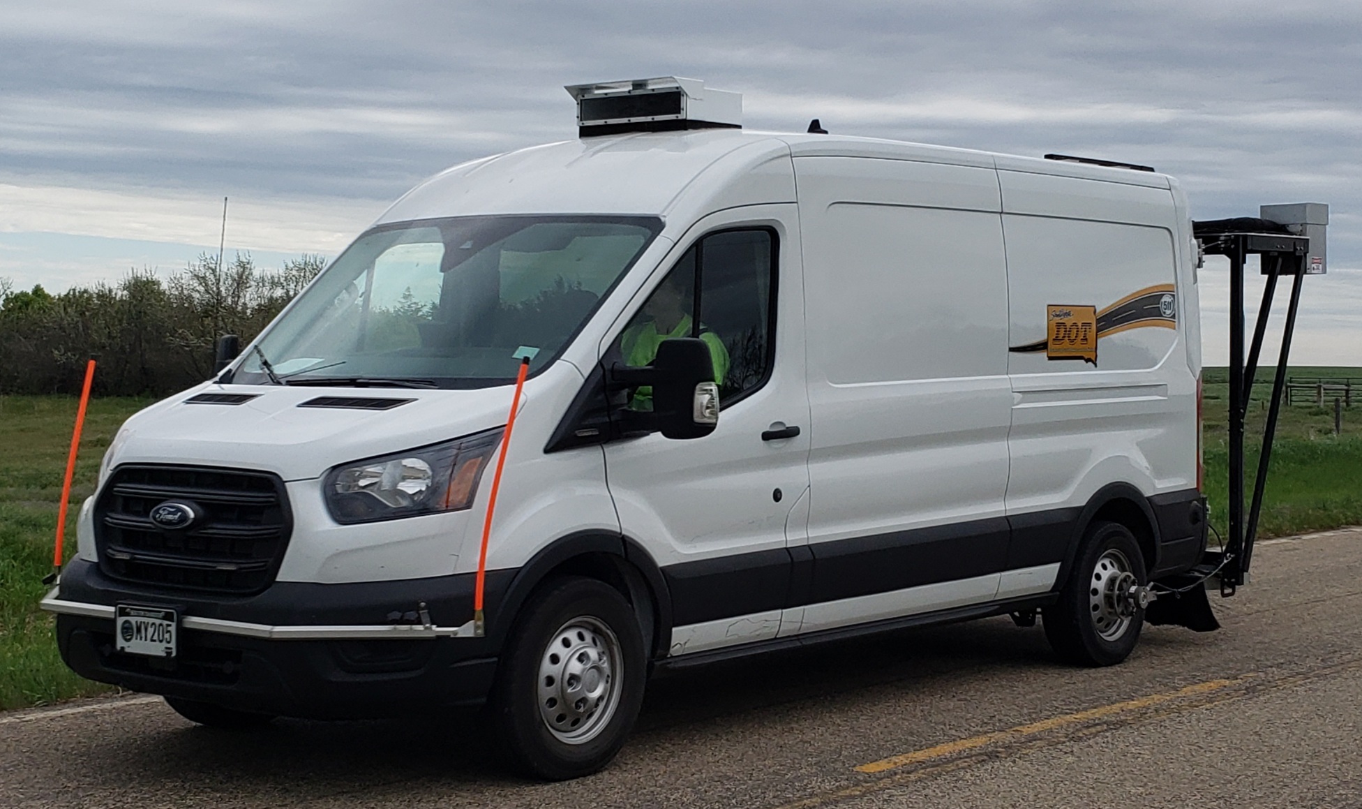
Pavement Condition Monitoring
Pavement Condition Monitoring
Pavement Condition Monitoring uses sophisticated equipment to collect digital data about road surface profile, rut depth, slab faulting, pavement strength, and videologging. These data are utilized in pavement design and management, structural adequacy for load limit posting, and planning for the annual highway needs analysis/construction program. This activity is also responsible for updating the Roadway Information System (RIS) resulting from physical changes to the state highway system from annual highway construction and maintenance projects. Key components to the RIS database are Mileage Reference Markers, Roadway Features, Intersection, and Pavement Condition Measurement.
Surfacing Log
The Surfacing Log is a detailed report about the pavement surface of each section of State owned highway and includes the following information; surface width, type of material used to construct each layer of pavement, year each layer of pavement was constructed, thickness of the each layer of pavement, type of material use for the base course, thickness of the base course, and years that surface treatments were completed for each section of State owned highway.
Cover Page
Definitions
Cover Page
Definitions