Highway System Statistics
Highway System Definitions
State Trunk Highway System is comprised of the 7,720 miles of state-owned highways listed in South Dakota Codified Law. These include 679 miles of Interstate highways in South Dakota, 2,469 miles designated as U.S. highways in South Dakota and the 4,572 miles designated as South Dakota state highways.
State Highway System includes the State Trunk Highway System, plus 31 miles of state-owned roads not on the State Trunk Highway System (1), and 42 miles of roads neither state-owned nor on the State Trunk Highway System (2). The total is 7,793 miles.
National Highway System is a total of 3,695 miles of the Interstate system, some U.S. highways and South Dakota state highways are designated as part of the National Highway System due to their importance to the nation’s economy, defense and mobility.
Federal-Aid Highway System is comprised of the Interstates, U.S. highways, most South Dakota state highways and some local roads are part of the Federal-Aid Highway System, meaning federal funds can be used to resurface, reconstruct and expand these routes.
(1) Most of these 31 miles are short spur and loop routes owned by the state and
included in the state mileage certified by the Federal Highway Administration (FHWA).
(2) These 42 miles are routes that are part of the state’s FHWA-certified mileage but
located on U.S. government land, including Badlands National Park, Wind Cave
National Park and Mount Rushmore National Monument.
Source: Office of Transportation Inventory Management, 2020 data.
State Highway Surface Condition Index and Goals
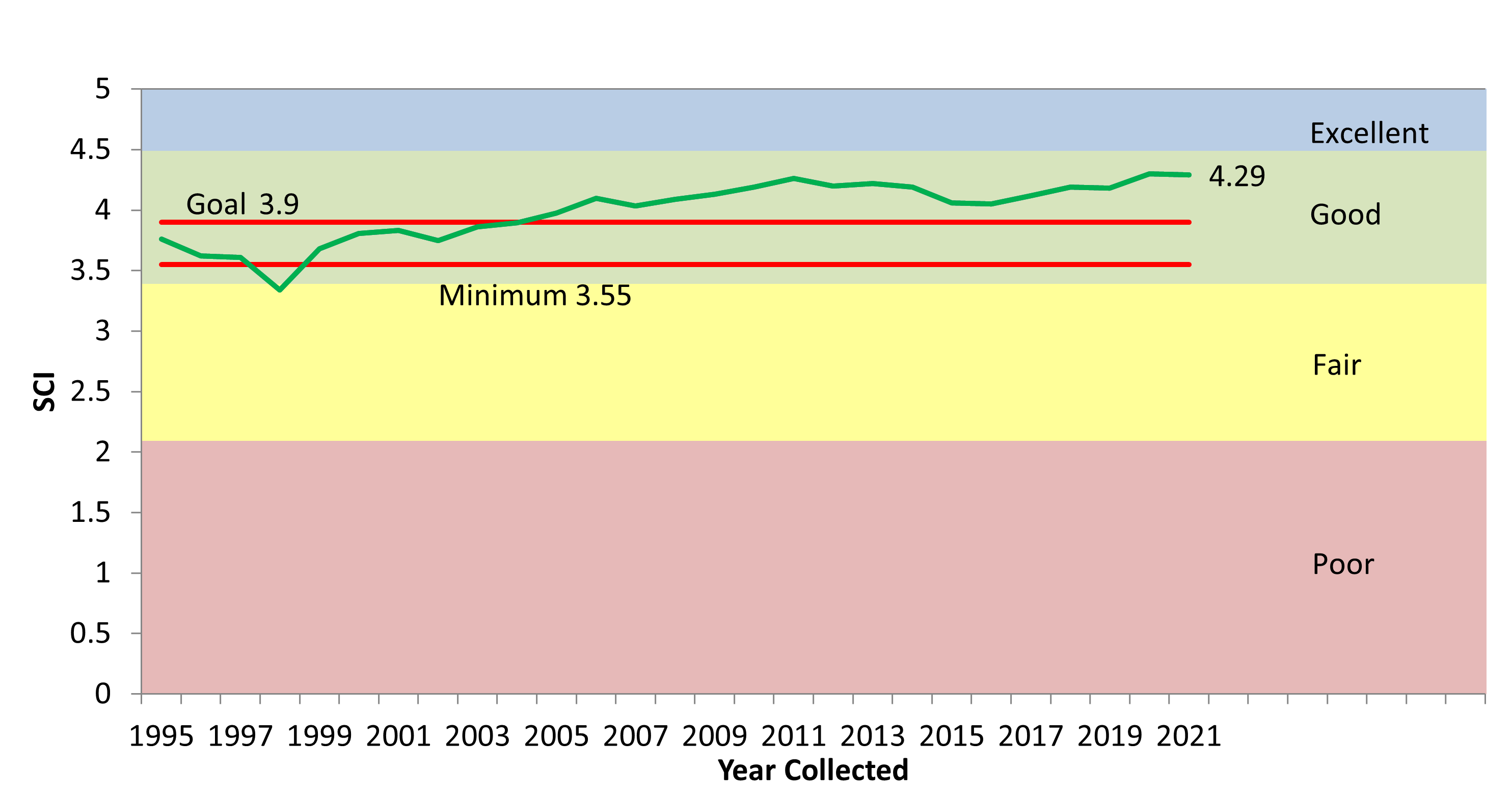
Source: SDDOT Office of Project Development.
Percentage of System Improved by Year
26% of the system was improved in 2021, including chip seal, routing & sealing, safety, signage, and resurfacing projects.
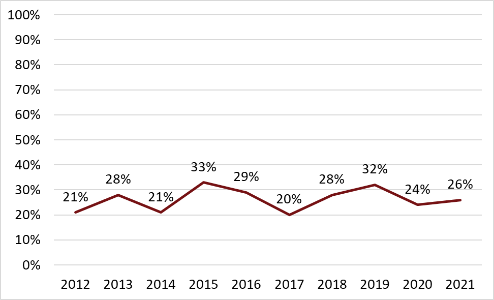
Source: SDDOT Office of Project Development, STIP data using center-line miles.
Excellent, Good, Fair, Poor Asphalt Roads
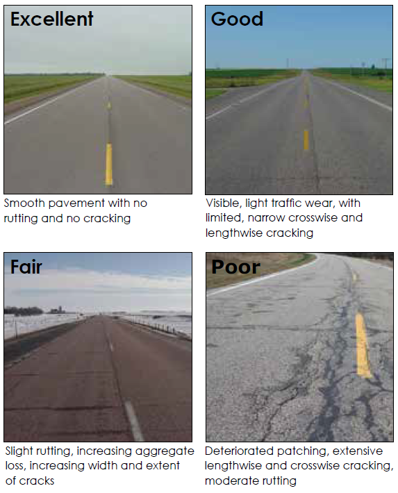
The Majority of Roads in S.D. Area Local

Source: Office of Transportation Inventory Management, 2020 data.
The State System Carries Most of the Traffic
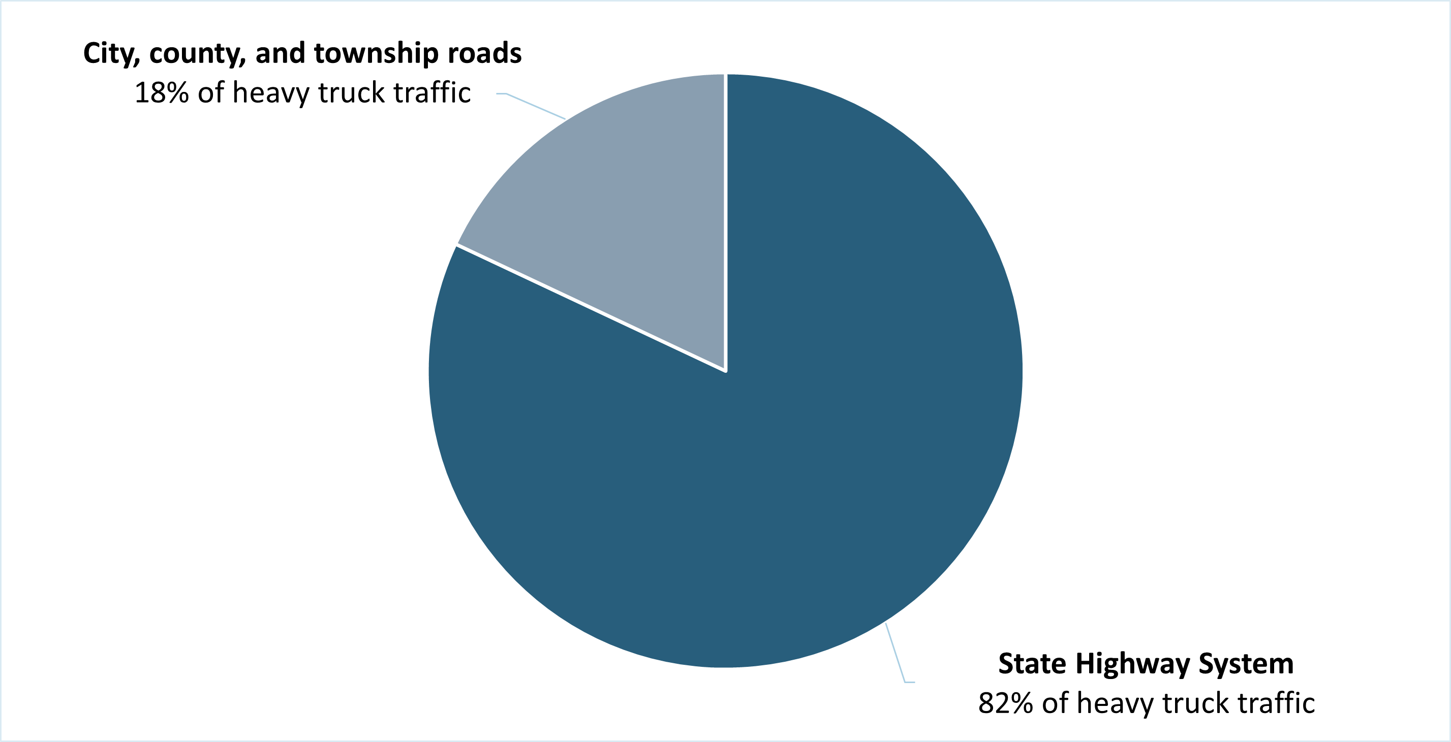
Source: Office of Transportation Inventory Management, 2020 data.
State System Carries Most Heavy-Truck Traffic
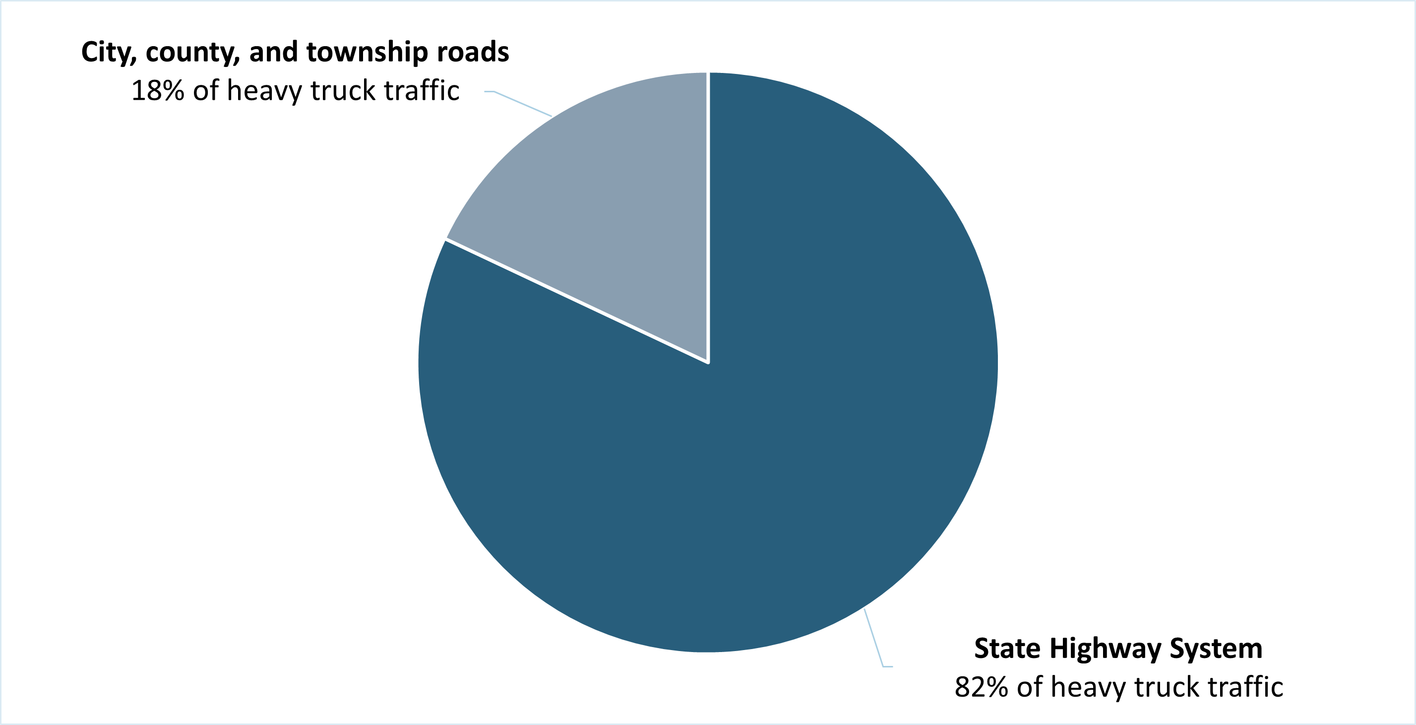
Source: Office of Transportation Inventory Management, 2020 data.
Vehicle Miles Traveled, State Highway System
Vehicle miles traveled (VMT) in billions
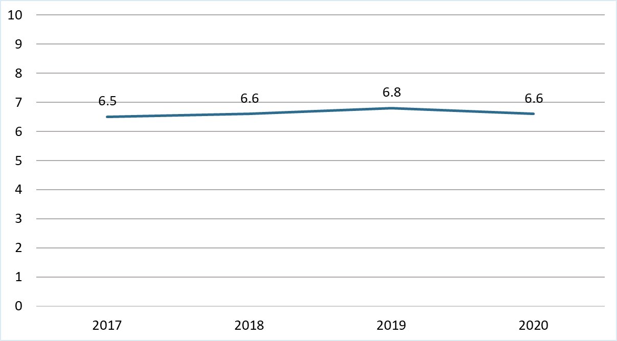
Source: Office of Transportation Inventory Management, 2020 data.
Most State Highways Are Asphalt Concrete
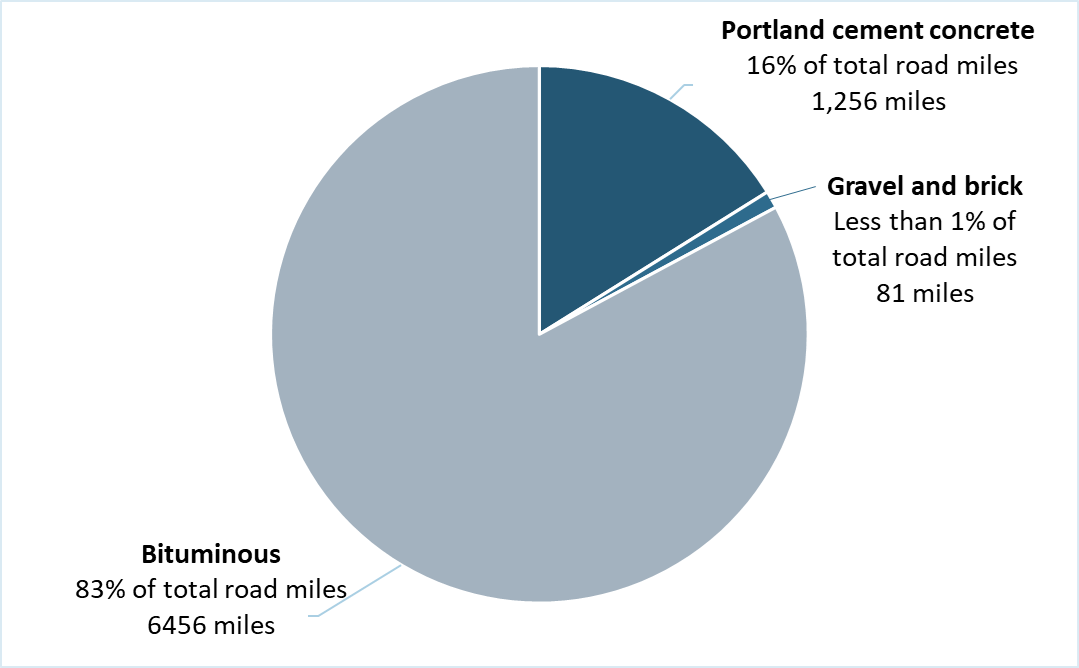
Source: Office of Transportation Inventory Management, 2020 data.
Age of Asphalt Concrete Pavements on State System
The average age of State Highway System asphalt concrete pavement
is 9.3 years
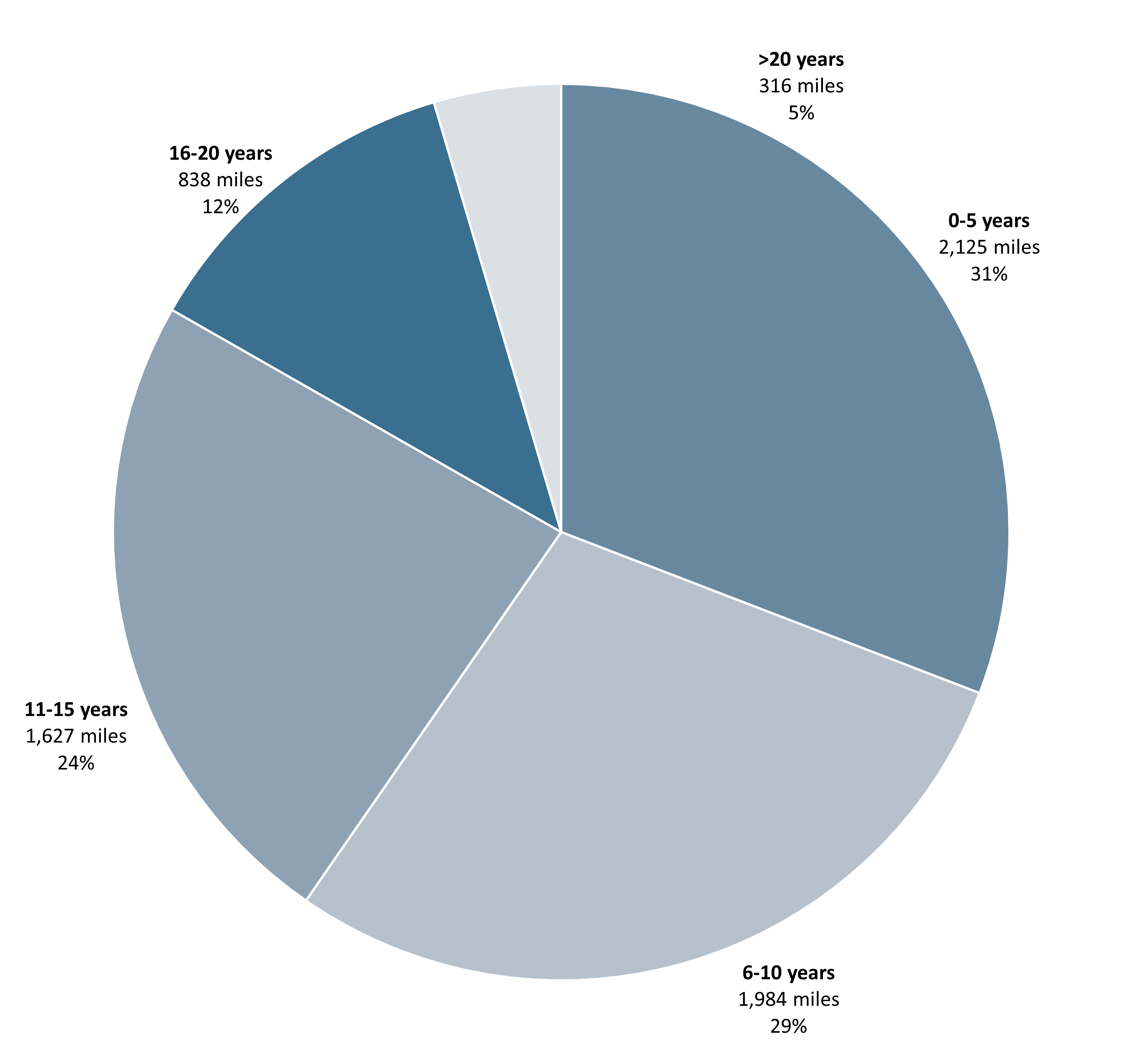
Source: Office of Project Development, 2021 data
Age of Portland Cement Concrete Pavements
The average age of State Highway System portland concrete
pavement is 16.9 years.
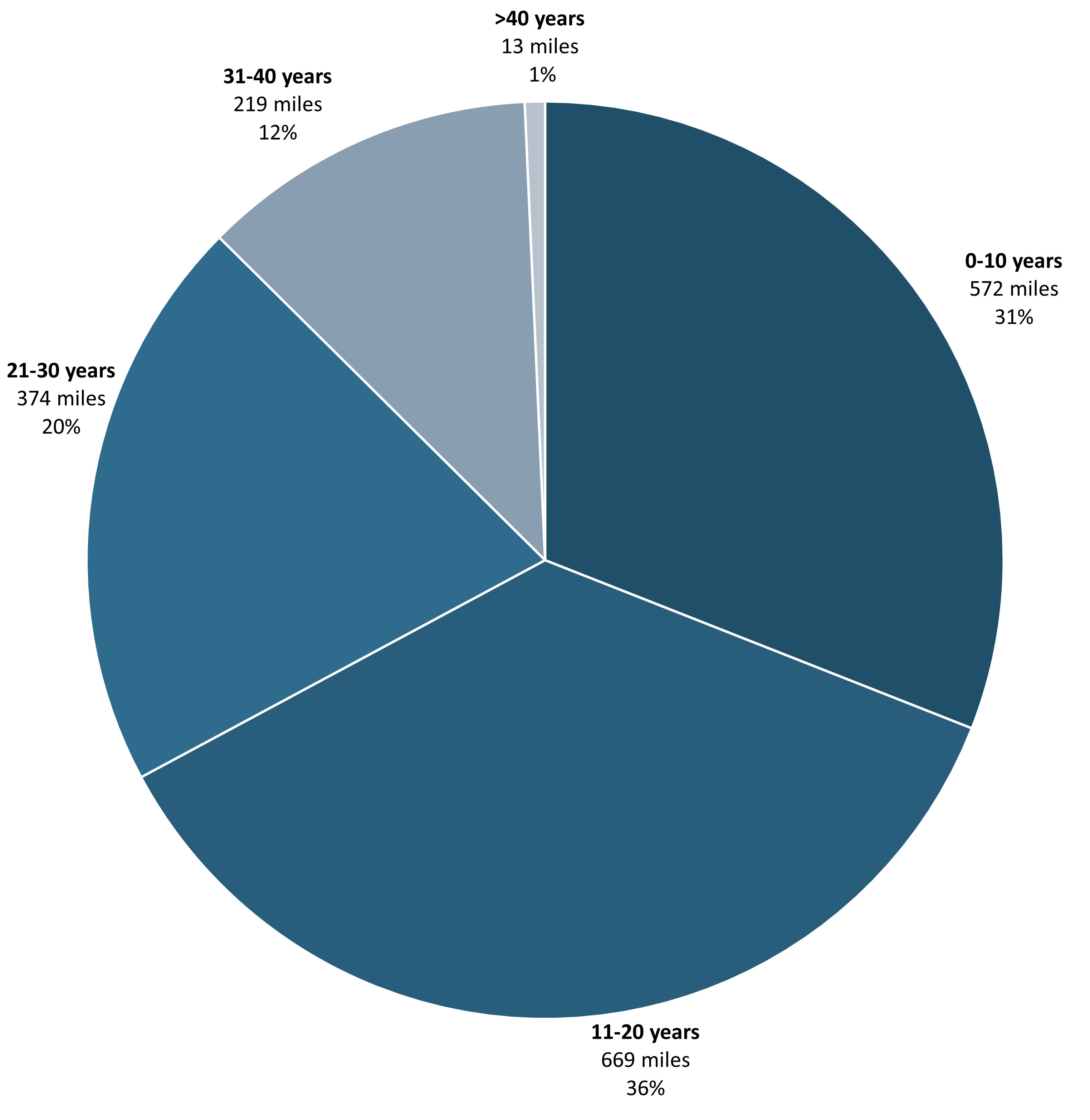
Source: Office of Project Development, 2021 data.
Most Local Roads Are Gravel
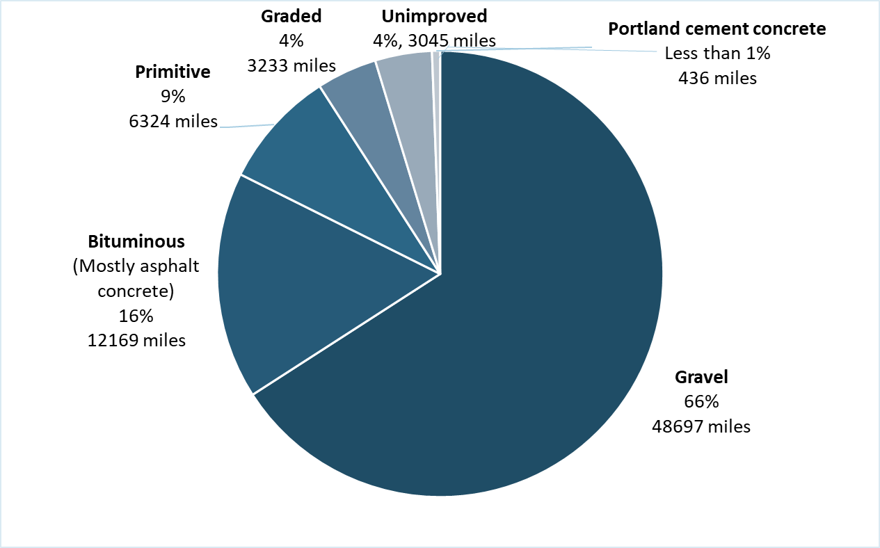
Source: Office of Transportation Inventory Management, 2020 data.

This specially equipped road and pavement data collection vehicle travels about 90% of the State Highway System each year, measuring roughness and recording roadway and pavement images.
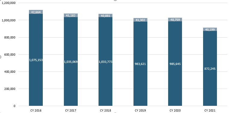
More Vehicles Are Using State Highways
CONTINUE READING THE FACT BOOK→